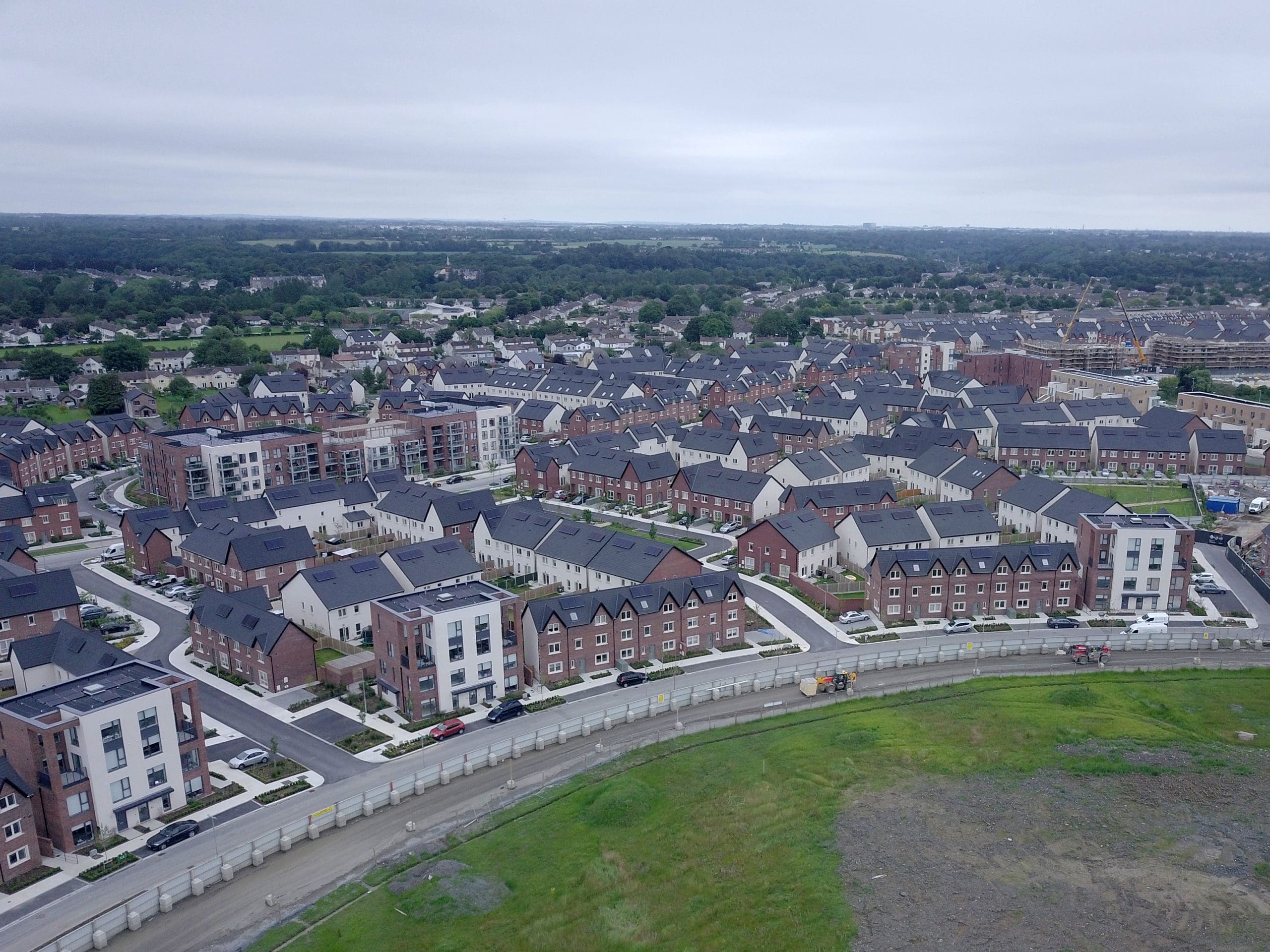
DBFL were appointed to provide engineering services for this large-scale Strategic Housing Development residential development in Clay Farm, Ballyogan, Dublin 18. The development comprised the construction of 425 units in Phase 1 and 927 units and bridge in Phase 2.
DBFL were involved from the initial greenfield site, through the full planning process and throughout the construction stage to project completion. The planning stage involved the following works: consultations with Dun Laoghaire Rathdown County Council, Inland Fisheries, Irish Water; flood plain optimisation including civil engineering and earthworks design to maintain flood volumes; development infrastructure design; planning, tender and construction (ongoing) duties; drainage design, including attenuation and flood control; design of 100m long road bridge linking Phase 1 and Phase 2; Sustainable Urban drainage systems (SuDS).
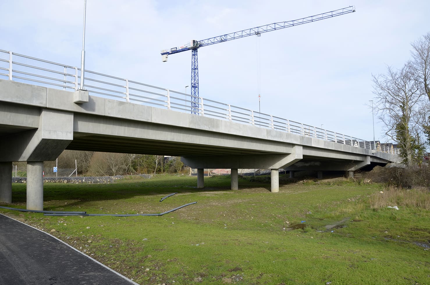
The bridge consists of four spans, each of approximately 25m in length. The bridge is a composite concrete structure consisting of an in-situ reinforced concrete deck on prestressed precast concrete bridge beams on an in-situ reinforced concrete sub-structure.
The reinforced concrete sub-structure at the internal piers consists of cross-head beams on columns on pile caps on piles. At the ends of the bridge, the reinforced concrete sub-structure consists of abutment walls and wing walls on piles. The piles are 350mm square precast concrete piles driven down to rock.
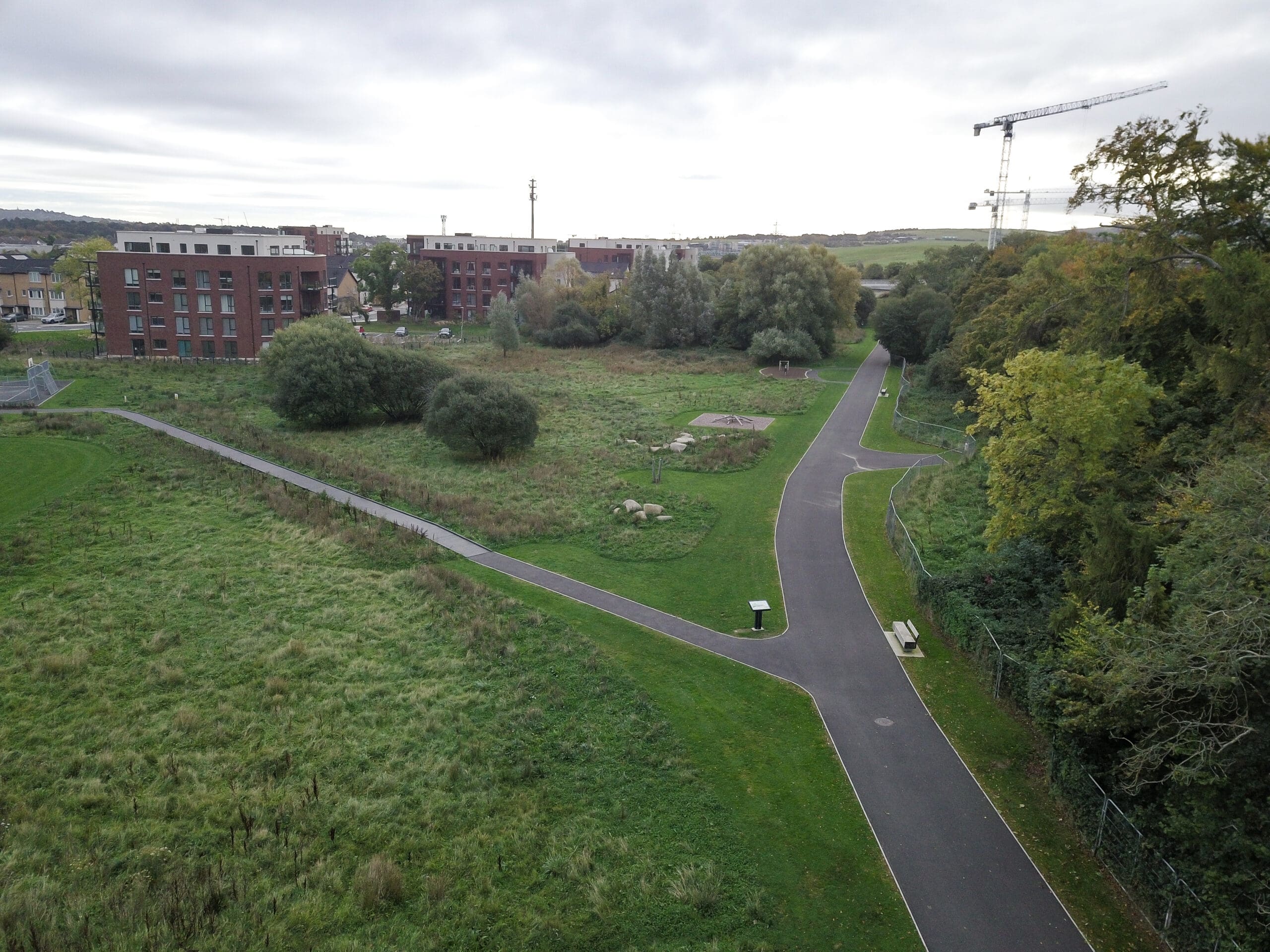


In order to maximise usable open space, the existing flood plain of the Carrickmines River had to be relocated a few hundred metres downstream. This proposal was designed in consultation with the Eastern Regional Fisheries Board and South Dublin County Council Park Department.
A catchment hydraulic model had been constructed in the past by another consultant which provided the existing flood storage volume. DBFL used HECRAS software to model the stream through the site and by adjusting the ground profile, relocated the flooding zone to the preferred location. DBFL organised and managed a surveying contractor to collect the necessary data including sections of the channel, floodplain, and structures.
The flooding levels were determined for different return period storm events in order to assist the landscape architect with the design of the flood area. A 3D model of the flooding area was also created (outside of HECRAS) in order to generate contours and cut and fill volumes for the earthworks.
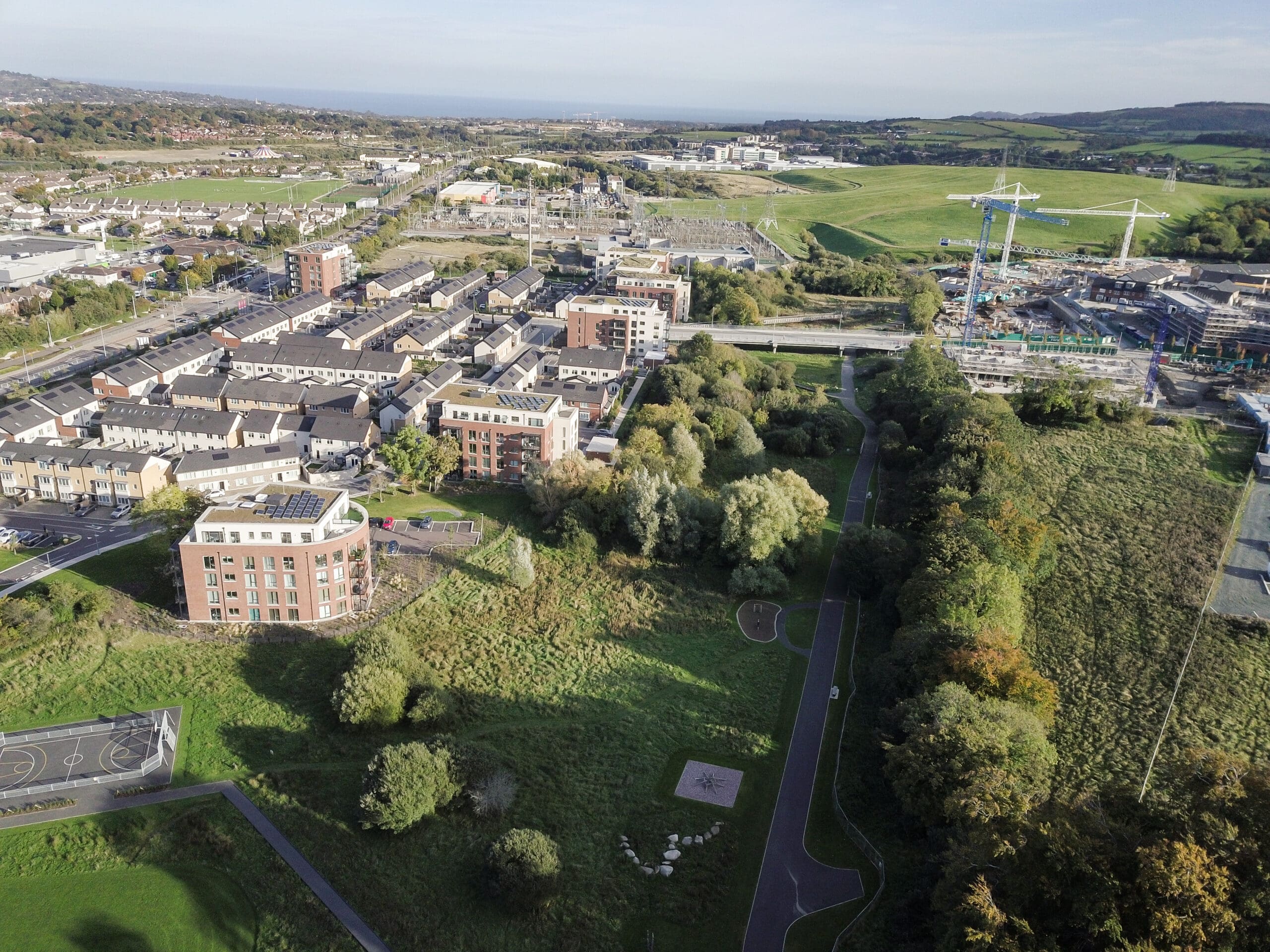
The project integrates environmentally responsible practices and innovative technologies to minimise environmental impact while maximising efficiency, quality, and longevity. DBFL’s pioneering approach to sustainable urban drainage systems (SuDS) replicates natural hydrological processes, effectively managing runoff, protecting downstream assets and floodplains, and demonstrating leadership in nature-based solutions and climate resilience. As part of the wider development, a 14-acre Eco Park was created along the Ballyogan Stream. This vibrant green space forms a vital link between Ballyogan Road and Cruagh Wood, tracing the historic Pale boundary and contributing to the DLRCC Green Infrastructure Corridor. The park safeguards natural habitats, enhances biodiversity, and strengthens community connections through a network of green corridors and walking trails. Through innovation and low-carbon design, the Clay Farm Eco Park stands as a model of sustainable development.

Project Director